Later floods reinforced the reality of living in a region vulnerable to the forces of water. Over the decades, these floods have come in many forms – some from localised downpours, others from widespread storms.
A long history of vulnerability
Floods are unpredictable and dynamic, and no two are the same. What stays consistent, however, is the vulnerability of low-lying areas to flooding.
Roads, such as Burke, Toorak, Rathmines and Auburn roads, often bear the brunt of heavy rain. They turn into fast-flowing waterways and create dangerous conditions for residents and commuters alike.
Glenferrie Road, near Gardiners Creek, is a particularly flood-prone corridor. Its low-lying valley often succumbs to heavy rainfall. Similarly, properties along Morang Road experience regular flooding, when water backs up the drainage system from the Yarra River.
The issue was clear as far back as October 1923, when houses along Morang Road and Yarra Street were partially submerged. Such scenes repeated in 1975 and 1977, creating a haunting familiarity for those who lived through these periods.
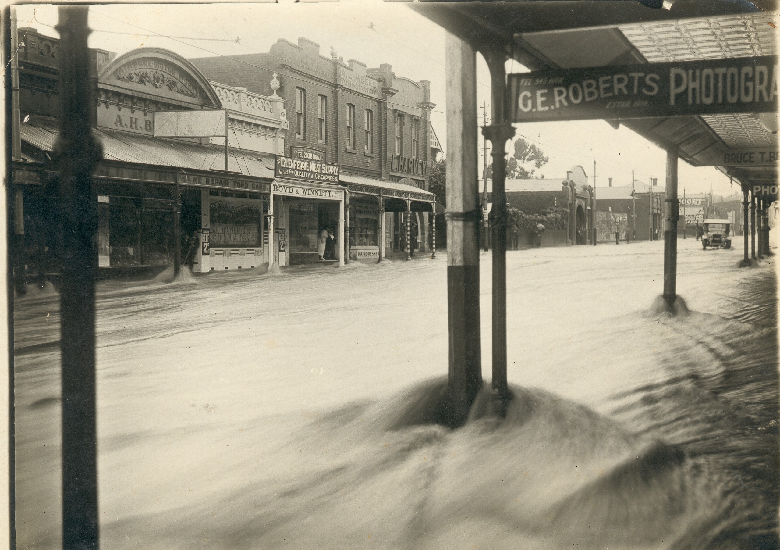
Hawthorn floods in 1921.
Flooding in recent times
In more recent times, the February 2005 flood struck with unprecedented intensity. In just 24 hours, an extraordinary 125mm of rainfall fell – the highest in 150 years. Streets, homes and businesses were inundated, underscoring the challenges faced by a community grappling with its geography.
The 2011 series of storms, fuelled by Cyclone Yasi in Far North Queensland, were stark reminders of the need for flood awareness and preparedness.
In January 2011, 146mm of rain in just 15 hours led to a dramatic 5.6m flood at the Gardiners Creek gauge. This was powerful enough to wash away the Solway Street pedestrian bridge in Ashburton.
On 4 February 2011, 99mm of rain swept through Kew, Hawthorn and surrounds in a single day. Areas like Camberwell Junction were completely submerged. The Rivoli Cinema complex and neighbouring restaurants bore the brunt of the storm, exemplifying the significant damage inflicted on local landmarks.
A similar intensity marked the destructive city-wide storm of 2016. Glen Iris was crippled with flash flooding, road closures and train delays. These events were part of a longer pattern, with water having reached the Ashburton train station platform in 2004 and 2006.
Lessons for the future
Fortunately no lives were lost during these events. But each flood left behind trails of property damage, transport disruptions and social upheaval. These make their way into people’s collective memory, shaping both community resilience and awareness.
The Hawthorn floods are not merely tales of destruction but lessons for the future. By combining lived experiences and documenting the impact of each event, the community gains a better understanding of how to support those living in flood-prone areas.
As history shows, floods will come again – unpredictable in their form, but certain in their presence. And with each wave, Hawthorn continues to learn, adapt and prepare for the inevitable.


