We’re working with local councils to update flood maps across Greater Melbourne. The maps show areas predicted to flood, now and in the future – so we can plan for our changing urban landscape and weather.
Help improve flood maps for your area
Even if you’re not an expert, your first-hand knowledge of flooding and the area can tell us a lot about what happens on the ground. We’ve started work to update flood maps for the following areas, and welcome your input during consultation.
List view
-
-
Flood maps in development
We’re working on updating maps for the following areas. Follow your local webpage for updates.
Moorabool (Bacchus Marsh & Ballan)
Map view
The coloured areas below show where flood maps are currently being updated. Click for more information.
More about our program
Flood maps don’t create flood risk – they help us better understand the risk that Melbourne faces. They provide valuable information that helps the Victorian Government, councils, emergency services and communities to:
- prepare for floods and minimise their impacts
- ensure new housing is built to withstand floods, and away from high-risk locations
- prioritise upgrades to flood infrastructure in high-risk areas.
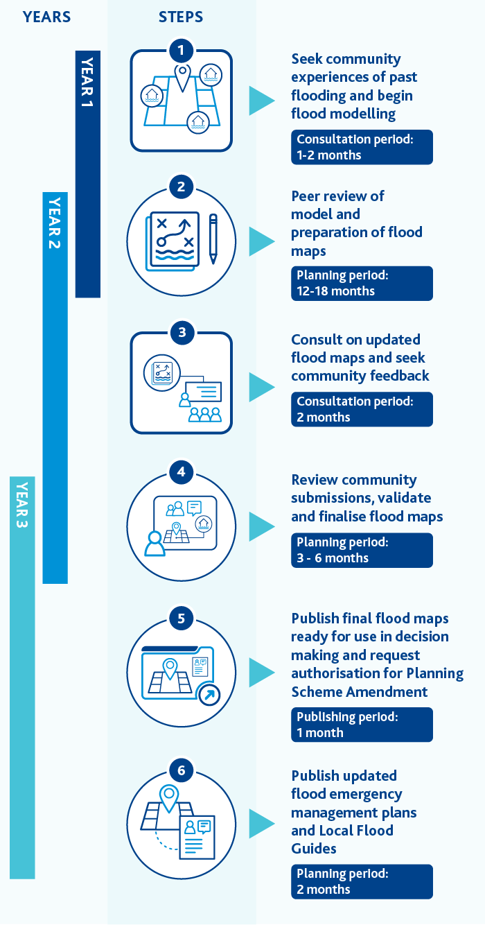
Program steps and timeline
Your local area may have multiple flood maps, due to the different types of flooding that occur – for example, from a river or overflowing drains. The maps may be updated at different times, but will go through up to six steps.
You can provide your feedback during the consultation phases. We encourage you to ‘follow’ your local webpage to stay informed of updates and opportunities to have your say.

| Year | Step | Timeframe |
|---|---|---|
| 1 | Seek community experiences of past flooding and begin flood modelling | Consultation: 1-2 months |
| 1-2 | Peer review of model and preparation of flood maps | Planning: 12-18 months |
| 2 | Consult on updated flood maps and seek community feedback | Consultation: 2 months |
| 2-3 | Review community submissions, validate and finalise flood maps | Planning: 3-6 months |
| 3 | Publish final flood maps ready for use in decision making and request authorisation for Planning Scheme Amendment | Publishing: 1 month |
| 3 | Publish updated flood emergency management plans | Planning: 2 months |
Related links
-
Real-time flood alerts
Sign up for flood warnings and alerts by downloading the VicEmergency App and setting up a Watch Zone.
-
Greater Melbourne Flood Information Program
Learn more about flood maps, flood models and our program.
-
Flooding and drainage
Understand how flooding can affect you, and how we work to minimise the impacts.
-
Prepare for flooding
Find checklists, guides and other resources to get your home or business flood-ready.
-
Insurance: are you covered?
The Victorian Government has tips on choosing your home and contents insurance, and making a claim.
-
Flood mapping updated for the future
Read the Premier of Victoria’s announcement on the new risk-based flood hazard rating system.
-
Floodplain management
Understand the role of federal, state and local government and other agencies in managing floods in Victoria.


